Aso: Land of Numerous One-and-Only Sites and Attractions

Print

1. Kabutoiwa Lookout
Video: https://youtu.be/cFz1AONnEWQ

I drove by car from Kumamoto Airport, my objective this time being Aso, a vast caldera terrain measuring 25 km north-south and 18 km east-west. Covering an area of 380 km2 and surrounded by an outer rim of mountains, Aso was formed by large volcanic eruptions that took place between about 270,000 and 90,000 years ago and boasts many sites of natural beauty. The local people here lead vibrant lives in harmony with the nature around them. About 30 minutes from the airport, the view suddenly opened to reveal some magnificent scenery. There are several observation points in the outer rim, so you can view Aso and the five peaks of Aso rising in the center from various angles. One of them is the Kabutoiwa Lookout, which offers a panoramic view of Aso surrounded by the outer rim of mountains rising around 400 meters high.

2. Cobblestones Trodden by Edo-Bound Daimyo
Video: https://youtu.be/Uc79gK02KsQ

Futae no Toge, a mountain pass located near the Kabutoiwa Lookout, was part of the Bungo Kaido road linking Higo (present-day Kumamoto Prefecture) and Bungo (present-day Oita Prefecture). Because it is the lowest point in the outer rim, rising to just around 200 meters, it served as a major thoroughfare for crossing the outer rim since olden times. In the Edo period (1603–1868), daimyo would use this pass when traveling from Kumamoto Castle to Edo for their stints of obligatory residence there under a system enforced by the shogunate at that time. The daimyo and their large retinues would cross this pass and then travel from the port at Oita across the Seto Inland Sea and then up the Tokaido highway to Edo. The journey is said to have taken several weeks. The cobblestones make one feel the weight of this solemn history.

3. Kusasenri-ga-hama
Video: https://youtu.be/4BeiyyYEbc0

I left my hotel in Aso by car just after 5 o’clock in the morning. After driving for about 20 minutes, I entered a road climbing up to Mount Aso. A little while later, the vista opened on a vast grassy plain and wetland, looking rather like a circular pond, and beyond I could see the volcanic smoke rising from the Aso Nakadake crater. Formed several thousand years ago, Kusasenri-ga-hama stretches out at the northern foot of Eboshidake, one of the five peaks of Aso. The scenery of vast grassland and two ponds, said to have been formed by rainwater collecting in old craters, has a strange kind of beauty, giving one the illusion that it does not really belong here on Earth.

4. Aso Nakadake Crater
Video: https://youtu.be/RA8DNxkKjko

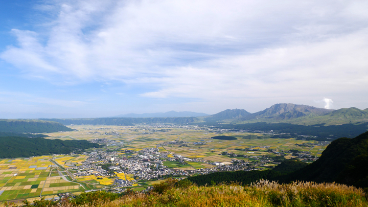
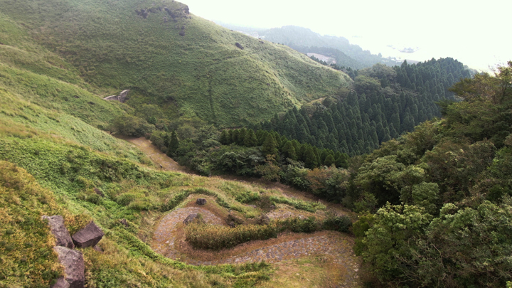
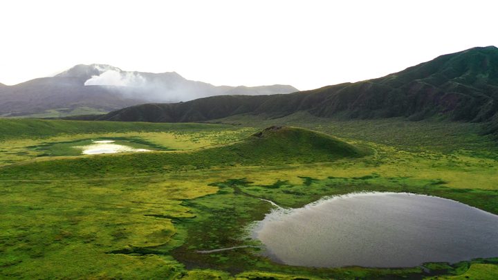
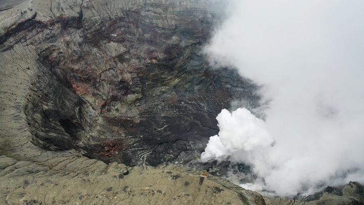
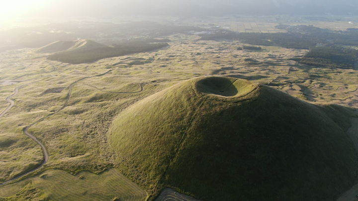
Driving farther along the road, I came to several buildings and an imposing gate. This was the entrance to the Nakadake crater. If there is warning of an eruption, or if dangerous volcanic gas accumulates due to the direction of the wind, this gate closes. As soon as I passed through the gate, the scenery changed. The grassland that I had been admiring until then gave way to a hair-raising landscape of rocks and boulders. The dark brown color further intensified the atmosphere. This is what hell must be like, I thought. After I had driven for a few more minutes, the crater came into view. I stopped the car and headed toward the crater. There was a distinct smell of sulfur in the air, and I could hear a faint sound coming from the crater. Looking down at the crater over a fence, I could see right to the bottom. No water had collected there, but it was emitting smoke. The Nakadake crater has a diameter of 600 m, a circumference of 4 km, and a depth of about 130 m. It is one of the few places in the world where you can view an active crater. Apparently it gets more than one million visitors a year.

5. Komezuka and Kishimadake
Video: https://youtu.be/tdlBS3z2agk

A little way down from the crater there was a beautiful cone-shaped hill called Komezuka. Formed about 3,000 years ago, this volcano, known as a scoria cone, was created when erupted magma rapidly cooled. The hill is so beautiful, one wonders whether it is not artificial. The peak that rises on the Mount Aso side of Komezuka is Kishimadake. The rough surface of Kishimadake is the result of the Kumamoto earthquake in 2016.

6. Nabegataki Falls
Video: https://youtu.be/V0fOrNYQDZQ

This curtain-like waterfall falls into the Horai River in northern Aso. Going down the well-kept steps, you can see the beautiful spray right before eyes. You can also go round to the back of the waterfall. Nabegataki Falls became a popular spot after appearing in a television commercial.

Daikanbo is the most famous of the many observation sites in the Aso outer rim. From this northern part of Aso, you can view the whole area. The smoke rising from the central Mount Aso crater is especially impressive.

8. Ikeyama Spring
Video: https://youtu.be/88BcSdECBoI

Looking back on Aso’s history, one can understand how this terrain was created by the fiery land and flowing water. Among the many springs in Aso, Ikeyama Spring is especially beautiful. It has been designated by the Ministry of the Environment as one of the 100 best springs in Japan.

9. Minami-Aso Railway
Video: https://youtu.be/1uNrBqcRI6k

This railway line was operated by the former Japanese National Railways, but now it is managed by a local third-sector company. It suffered damage in the Kumamoto earthquake in 2016, and part of the line is still closed. The bright red carriage and yellow ears of rice make an adorable contrast.

10. “Milk Road”
Video: https://youtu.be/v5MdGlEcUc0

“Milk Road” is the nickname of a 50-km stretch of prefectural roads running atop the northern outer rim. It gets this name from the fact that this route is used to carry milk taken from cows on nearby livestock farms. There are no utility poles or anything like that, so you can enjoy a breezy ride across the highland. The cliffs of the outer rim loom close by. The view from above is rather thrilling.

Postscript
I spent three days taking videos around Aso. I was amazed by the unique scenery everywhere. Centering on the five peaks of Aso, the inner side of the outer rim has expansive paddies and fields, mountainsides, and clusters of houses here and there. Around 50,000 people live in this area. Mr. Masayuki Wada, an Aso Global Geopark guide who accompanied me on this photography tour, told me, “Aso has everything people need to live. Absolutely nothing is wasted. There is a reason for the origin of everything. This is a place where coexistence with nature goes very well indeed.” The attraction of this land is that everything is a one-and-only existence. I have traveled to many places across Japan to take photos and videos. Without doubt, Aso was one of the most impressive.

Photos and text: Arata Matsumoto, Sharata and Adwise, Inc.
URL: 
http://www.sharata.net/ (Japanese)
(Sharata supplies 4K videos of outstanding scenery in Japan so that as many people as possible can enjoy it.)

Japanese Page →